

A folded structure
The Geology of the Park
Costa Quebrada is an exceptional setting to enjoy and understand the rich geological substratum contained in it. A large fold, the syncline of San Román-Santillana, stretches southwest from the peninsula of Santander and shows the magnitude of the forces that shape the planet. These forces even tilt rock strata to a vertical position in the northern side of the syncline.
The rock layers hold valuable information that allows to reconstruct an over 100-million-year geological history. The past environments in which rocks deposited and hardened, as well as the folding and uplifting processes caused by the movement of tectonic plates, are illustrated in a clear manner.
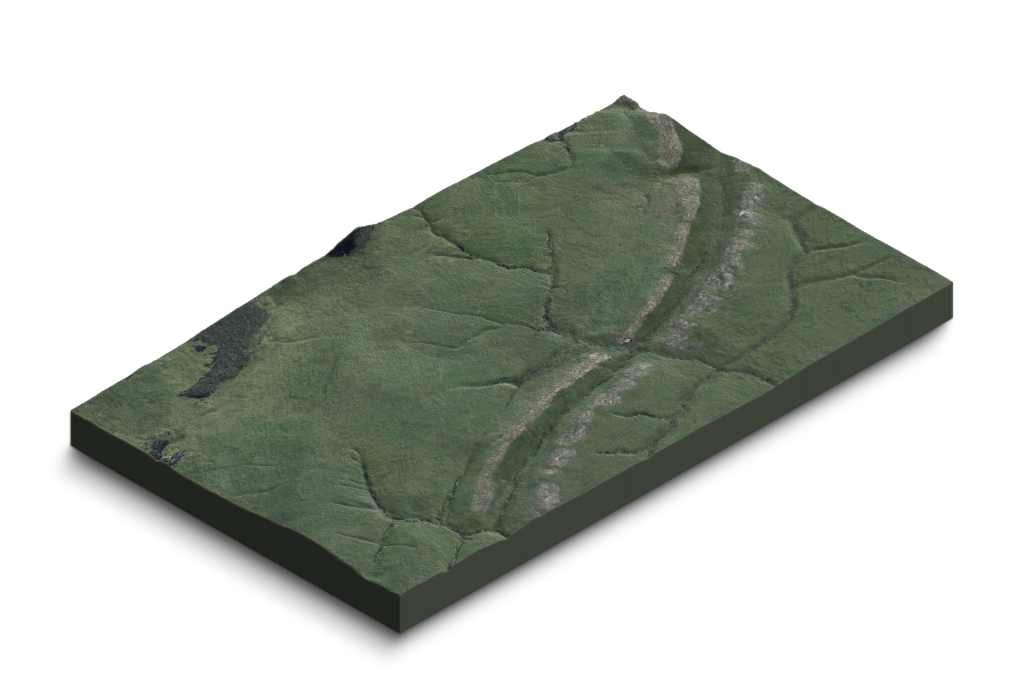
Marine erosion, together with the complentary action of rainwater and overland flow, streamflow and subsurface flow (in the form of rivers, torrents and subterranean streams), creates a unique geological landscape. The substratum fully opens up at the cliffs and the wave-cut platforms, carved by the action of waves. There it shows us every geological secret that this unique area hides.
If you would like to know the main highlights in the Park, please visit the SITES OF GEOLOGICAL INTEREST MAP.

Marine erosion
THE EVOLUTION OF THE LANDFORMS
Costa Quebrada exhibits an extremely rich and appealing string of coastal forms in a short stretch, but it also shows the patterns of coastal erosion very clearly, thus making possible to reconstruct the evolution of this coastal ensemble over time.


1. The Ice Age
During an ice age the sea retreats back several miles, exposing a wide coastal plain that is shaped by the running waters.
Two long limestone ridges cross the land acting as barriers. Rivers only can go across them along the faults that fracture these barriers.
2. The arrival of the sea
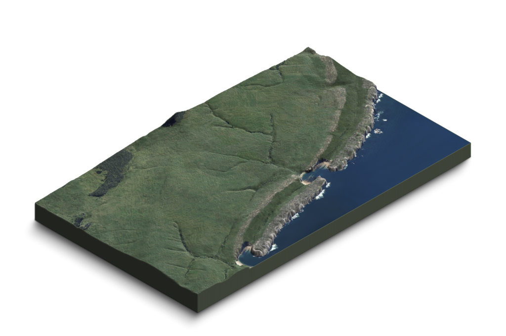
The sea level rise that follows the ice age floods the coastal plains. Wave action wears away the weak rocks, and erosion moves forward until the first resistant limestone ridge slows the process down.
The waves make their way through gaps carved along faults, and quickly erode the soft sandstones and clays, starting to shape arched inlets.
3. The dismantling
Weak rocks, such as sandstones, siltstones and marls, are only preserved where resistant limestone ridges shelter them. The first ridge is slowly worn away by the wave action.
Erosion slows down again when waves reach the second limestone ridge, but waves start carving the soft marls behind it. Wherever erosion advances, arch-shaped inlets and sand beaches are formed.
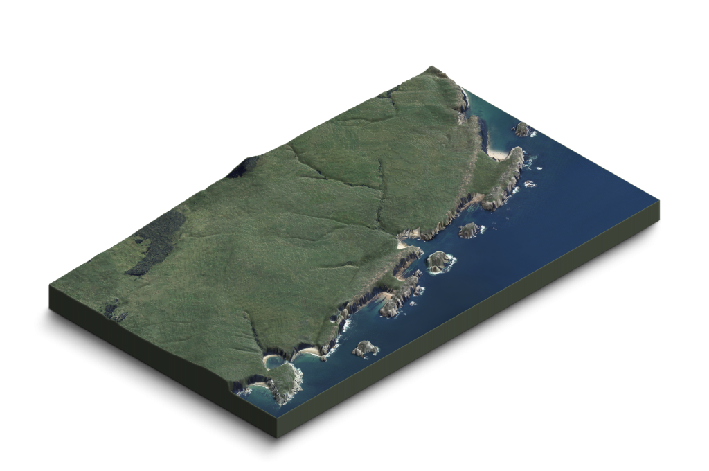
4. Our days
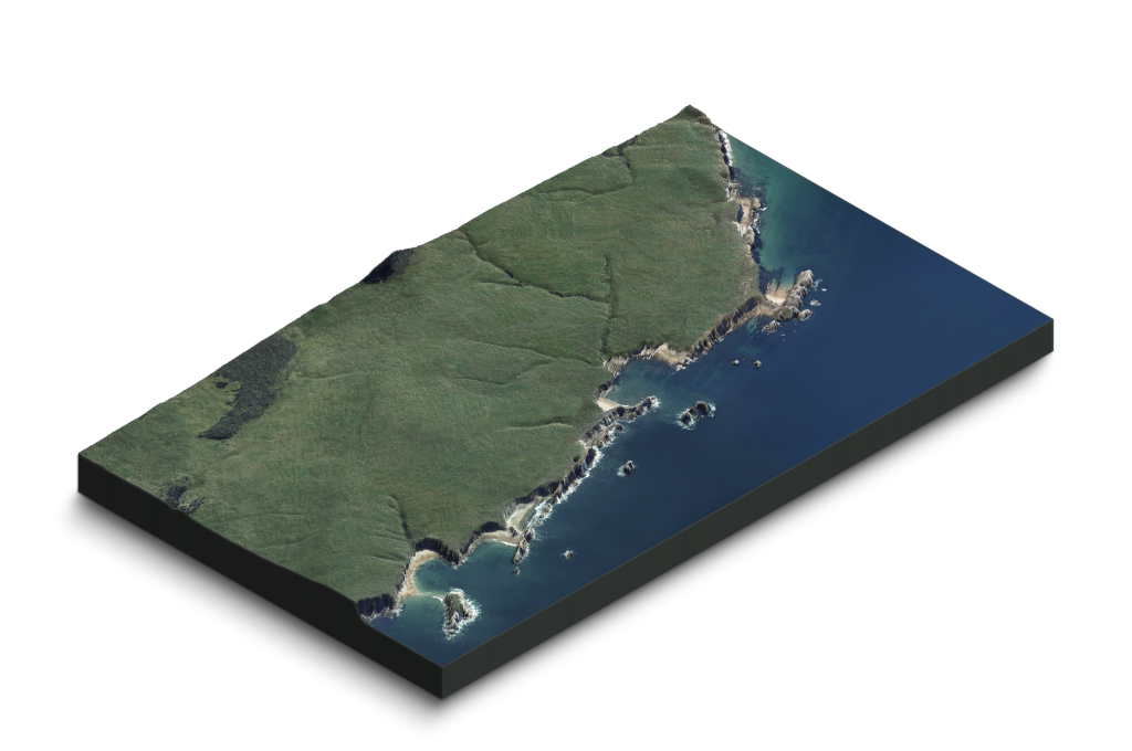
Erosion continues dismantling the resistant limestones in the first ridge, almost reduced to small islets and stacks (locally named Urros) in this stage.
The inlets, bordered by high cliffs, keep widening and overtaking the mild rolling hill and small valley scattered landscape. And erosion continues…
The Geological History
When, 120 million years ago, the first Cretaceous materials of Costa Quebrada were first deposited, they were in the warm and clean water of the Tethys Sea. Meanwhile, reptiles dominated the living world in the far-off emerged lands. However, large reefs were developed here under the clean water, made up of certain molluscs, the rudists, and some corals.
As these reefs became larger, voluminous masses of Aptian Cretaceous limestone rock were formed. Nowadays, once emerged, they arise as significant rock masses along the La Marina and the limestone massifs east of the river Miera. Their mining potential has always been of great interest in Cantabria. This is confirmed by the mining activity carried out at Cabárceno, Reocín, Puerto Calderón, and the countless quarries of Camargo and Eastern Cantabria.
But nothing lasts forever in the long history of our planet and, after five million years, the placid waters were disturbed by a change in rainfall patterns and the sea level.
During the Albian, 112 million years ago, sediments transported by the rivers coming from the south and the west buried the rudists and corals and thus hindered their survival here. Initially, only the finest sediments (silt and clay) arrived. They were loaded with plant debris, wood from forests and small resin fragments. Ancient insects have been found in some of these resin fragments (amber), elsewhere in the basin.
The dark silts filled the basin as they became thicker, resulting in coastline advance. Near the coastline, the sandbars of a vast beach were deposited, burying the silts. However, the sea level rose on several occasions and, with each rise, the dark silts buried the sands once again, accumulating in thick layers until they filled the basin and the sands returned.
The siltstones and sandstones found today at the isthmus of Somocueva were formed this way. They can be found along the central coastline of Cantabria, too, from Suances to Comillas and the inner valley of the river Nansa.
These silt / sand cycles were not exactly alike. Over time, each new sand deposit contained more calcium. Consequently, the sand deposit would gradually become a new limestone deposit, where the many marine organisms that died would remain, trapped and fossilised. Ammonites, sea urchins, sea snails, corals, sponges, and many other organisms were part of rich marine communities.
The limestone sank slowly into the basin until the deposition stopped. Furthermore, the quantity of dissolved oxygen in the sea experienced a substantial decrease at the end of this process, which led to an important mass extinction of marine species.
This way, a layer of ochre coloured limestones originated, the same renowned Cenomanian limestones that our ancestors used to paint their beliefs and their world in Altamira.
The inert reef, which was now deep in the waters of a colder, poorer sea, was then buried by new sediments. The almost lifeless clays burst onto the scene.
As they were being deposited, the climate didn’t remain the same. Periods of tens or hundreds of thousands of years of warm, humid weather were followed by long periods of cold, dry weather. These fluctuations determined the type of sediments that would reach the basin.
During long years, copious rainfalls would load the basin with clays, whereas in other times, clays were less abundant and shell and calcium-rich debris deposition would predominate. This calcium cemented the clays when it was most abundant, originating more resistant alternating layers. Irregular sea urchins, corals, sponges, ammonites, bryozoans and many other organisms lived in this environment.
This cyclic process took place countless times from the Turonian to the Santonian, creating the series of thin layers of marlstone and gray limestone found along the cliffs of eastern Costa Quebrada.
From the Maastrichtian onwards, about 70 million years ago, this little basin began to rise, slowly. Consequently, sands gradually became present again, along with the influence of currents. The sandy limestones found between Covachos and San Juan de La Canal were deposited in this environment.
This was the case until the end of the Mesozoic, 65 million years ago. With the mass extinction that put an end to the dominance of large reptiles, many other creatures also became extinct. At that time, sandy materials became exposed to the elements, in the middle of some coastal brackish lagoons. Certain very soluble rocks were deposited there-the dolomites of the cove of La Canal.
The coastal environment of the sandy deposits, constantly movilised by currents and waves, fostered the formation of the most recent materials of Costa Quebrada-the calcarenites and limestones found near the island of Virgen del Mar. Numerous sea urchins, annelids and sponges lived in this hectic environment.
Already at that time, the collision between the African and the European continents began. The Iberian island was compressed against Europe, causing the uplift of all the mountain ranges in southern Europe: the Cantabrian Range, the Pyrenees, the Alps, the Balkans and the Carpathians.
STRATIGRAPHIC COLUMN
This graphic shows the materials of the outcrop of Costa Quebrada. Age (millions of years, m.y.) and rock composition are indicated. The two boundaries, Cenomanian-Turonian (C-T) and Cretaceous-Paleogene (K-Pg, former K-T) are also shown, given their connection with biological extinctions.

THREE-STAGE FORMATION
The geological landscape of Costa Quebrada originated in three stages, completing a geologic cycle. The sediments that originated the current rocks of the Park were the result of the erosion of older materials, the same way that the sediments produced by current erosion will constitute the rocks of the future.
1. Sedimentation

2. Folding

3. Erosion

SEA RASAS
The action of the sea is the main cause of the erosion processes that originate this landscape. As these materials undergo folding and uplift, different sea levels created different platform levels.
Marine erosion of an abrasion platform

Continental uplift

Marine erosion of a new platform

New continental uplift

Marine erosion of a third platform

New continental uplift

The Rocks in the Park
The long geological history of Costa Quebrada, as well as the different events that took place here, originated a certain diversity of sedimentary rock materials, packed in a series of clearly differentiated formations.
Each of these formations is a chapter of the vast book that tells us the history of our Earth . The information that helps us complete this story can be extracted from its pages.
The different types of rocks found at the Geologic Park are listed below, in increasing order of age.

Sands

Tufa

Calcarenite with Schizaster sp.

Marls and calcarenites

Nummulite limestone

Calcarenite with flint

Thanetian limestone
Thanetian limestone
Thanetian limestone

Nodular limestones

Marl-limestone rhythmites

Discordant marls

Turbidites

Limestone

Cross-lamination sandstone

Siltstone


